Char Dham All-Weather Road: Engineering the Himalayan Highway to the Shrines
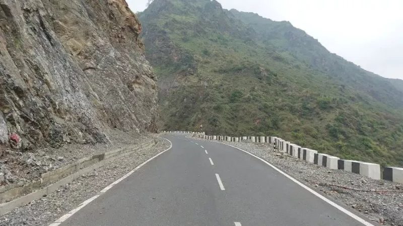
Every year, lakhs of pilgrims climb to the four shrines of Uttarakhand’s Char Dham: Yamunotri, Gangotri, Kedarnath and Badrinath. For decades the journey meant narrow, landslide-prone mountain roads that closed in winter and choked in the yatra season. The Char Dham all-weather road project, launched in 2016, set out to change that: roughly 900 kilometres of widened, stabilised highway connecting the four shrines, engineered to stay open through the year. It is one of the most ambitious mountain-road projects ever attempted in India, and also one of the most contested, with environmentalists warning that cutting wider roads through the fragile Himalaya courts disaster. Both the engineering and the controversy deserve a close look.
What the project builds
The project widens existing mountain roads to two lanes with paved shoulders along routes to the four dhams, with bypasses, tunnels and bridges at critical chokepoints. Key structures include tunnels that bypass landslide-prone stretches and bridges over the Bhagirathi, Alaknanda and Mandakini rivers. The “all-weather” promise rests on slope stabilisation, retaining walls, drainage and avalanche protection, designed to keep the roads motorable even in winter and monsoon. For pilgrims, the difference is tangible: wider roads mean fewer traffic jams on narrow ghat sections, safer overtaking, and quicker evacuation when disaster strikes. For the army, the roads double as strategic logistics routes to the border areas.
Engineering at altitude
Building in the Himalaya means blasting through some of the youngest, most fractured rock on earth, in a zone of high seismic risk. Engineers use controlled blasting, rock bolting, wire-mesh slope protection and bio-engineering to hold cut slopes in place. Tunnelling through water-charged, squeezing ground has caused collapses and delays, most dramatically in the Silkyara tunnel episode, where workers were trapped and rescued in a operation that gripped the nation. High-altitude construction seasons are short, materials must be hauled up narrow roads, and every monsoon tests the new slopes. It is civil engineering at its most unforgiving.
The environmental controversy
The project’s fiercest critics argue that widening roads in an ecologically fragile, landslide-prone zone multiplies the risks: hill-cutting destabilises slopes, muck dumped into rivers chokes them, and deforestation for wider alignments removes the root systems that hold mountainsides together. The 2013 Kedarnath disaster and subsequent flash floods are invoked as warnings of what the Himalaya does when provoked. Petitions reached the Supreme Court, which set up oversight committees and ordered slope-stability and environmental safeguards. The government responds that the roads are a strategic and humanitarian necessity, that pilgrims die every year on the old roads, and that modern engineering with proper mitigation is safer than the status quo of narrow, crumbling tracks.
Who uses the road
The primary users are the Char Dham pilgrims, whose numbers have grown steadily, with the yatra now drawing lakhs each season and the state promoting year-round tourism. The roads also serve the resident hill population, for whom an all-weather connection means access to hospitals, markets and education through the winter. And they serve the military: the same corridors feed forward areas along the border, which is why the project enjoys strong strategic backing regardless of the tourism economics. This triple use, pilgrimage, civilian lifeline, military logistics, is what makes the project politically unstoppable even as the environmental debate continues.
The balancing act
The honest framing is that both sides are partly right. The Himalaya is genuinely fragile, and badly executed hill roads genuinely kill, through landslides, sinking and flash floods amplified by muck dumping. But the old roads were also dangerous, and connectivity is a legitimate aspiration of hill communities, not just of pilgrims and generals. The project’s legacy will depend on execution quality: whether slopes are genuinely stabilised or merely cut, whether muck is disposed scientifically or tipped into rivers, and whether oversight committees have real teeth. In the Himalaya, the margin between a lifeline and a wound is measured in engineering discipline.
FAQs
Which shrines does the Char Dham road connect? Yamunotri, Gangotri, Kedarnath and Badrinath in Uttarakhand, via about 900 km of upgraded highway.
Why is the project controversial? Environmentalists warn that wide hill-cutting in the fragile, landslide-prone Himalaya risks ecological damage and disasters; the government cites pilgrim safety and strategic needs.
What was the Silkyara tunnel incident? In 2023, a section of an under-construction tunnel on the project collapsed, trapping 41 workers who were rescued after a 17-day operation.
The Char Dham road is a test of whether India can build boldly in the mountains without breaking them. The pilgrims will keep coming; the question is what kind of road, and what kind of Himalaya, they find.
Compiled by the Khabar 24h Editorial Desk from publicly available sources.

Khabar 24h Editorial Desk — our explainers are prepared by the Khabar 24h editorial team using AI-assisted research tools, and every piece is reviewed by a human editor before publishing. We do not claim original reporting: our work is turning complex topics into simple, accurate summaries. Spotted an error? Write to contact@khabar24h.com — our corrections policy aims for same-day review.
More from this author →