FASTag to GNSS: How India Collects Tolls on National Highways
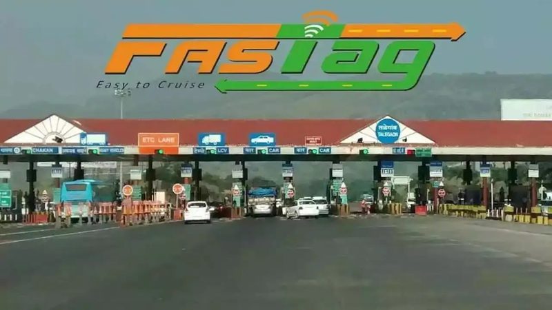
Every highway driver in India knows the small sticker on the windshield: FASTag, the RFID tag that made toll plazas cashless and cut waiting times dramatically. Since it became mandatory, electronic toll collection has covered nearly the entire national highway network. But FASTag has limits: you pay a fixed toll for a plaza-to-plaza stretch even if you exit early, and toll plazas themselves, with their barriers and lanes, remain bottlenecks. The government’s answer is GNSS-based tolling, a satellite system that tracks your vehicle’s movement and charges for the exact distance travelled, no plaza required. Pilots are underway, and the transition is one of the biggest changes in Indian road transport in a decade.
How FASTag works
FASTag is a passive RFID sticker linked to a prepaid wallet or bank account. As a vehicle passes through a toll plaza lane, an overhead reader scans the tag, the toll is deducted, and the barrier lifts. The system is operated by the National Highways Authority of India through the National Electronic Toll Collection programme, with banks issuing tags and the NPCI mapper routing transactions. Mandatory FASTag, enforced from 2021, pushed digital toll collection past 95 per cent of transactions and cut average waiting times at plazas from several minutes to under a minute. It was a genuine digital-public-infrastructure success, built on Aadhaar-linked KYC and UPI-era payment rails.
The limits of plaza tolling
FASTag’s weakness is structural. Tolls are charged per plaza, not per kilometre, so a driver who uses 10 kilometres of a 60-kilometre tolled stretch pays the same as one who drives the whole stretch. Plazas need land, cause local congestion and pollution from idling vehicles, and remain vulnerable to tag fraud and lane indiscipline. On expressways with closed tolling, entry-exit tracking solves some of this, but on open national highways the plaza model is inherently approximate. These limits are why transport economists have long argued for distance-based charging: pay for what you use, nothing more.
How GNSS tolling works
Under the GNSS (Global Navigation Satellite System) model, vehicles carry an On-Board Unit that uses satellite positioning to track movement along tolled highways. Virtual tolling points, or gantries, replace physical plazas: when the vehicle passes a gantry’s coordinates, the system computes the distance travelled on the tolled road and deducts the charge from the linked account. Trials have been conducted on select highway stretches, with the system using India’s own NavIC satellite constellation alongside GPS for positioning. Enforcement relies on automatic number-plate recognition cameras that catch vehicles without a working unit. The promise is barrier-free highways: no plazas, no queues, no stopping.
What changes for users
For highway users, the shift means fairer pricing: short trips cost less because you pay per kilometre. It also means the end of toll-plaza queues and the land-hungry plazas themselves, which can eventually be dismantled. But the transition raises questions. Vehicle owners will need to install On-Board Units, and the system must handle GPS blackspots, device tampering and billing disputes. Privacy concerns are real: a system that tracks vehicle movements needs strong data-protection safeguards, and the government has said location data will be used only for tolling. The rollout is expected to be gradual, starting with commercial vehicles and new expressways before extending to the wider network.
The road ahead
Globally, distance-based tolling is proven technology: Germany’s truck tolling and several European systems run on satellite positioning. India’s challenge is scale, hundreds of millions of vehicles, and the need to keep the system simple enough for a truck driver in Bihar and a commuter in Bengaluru alike. FASTag will coexist with GNSS during a long transition, and the RFID ecosystem’s success gives the government a template for managing the change. If GNSS tolling works at Indian scale, it will be the second great leap in road user charging, from cash to tag, and from tag to satellite.
FAQs
Will FASTag stop working? No. FASTag continues to operate, and GNSS tolling is being introduced gradually, starting with pilots and new corridors.
How is GNSS tolling fairer? It charges for the actual distance travelled on a tolled road instead of a fixed plaza-to-plaza fee, so short trips cost less.
Does GNSS tolling track my location always? The On-Board Unit records movement for toll computation; the government states the data is used only for tolling, though privacy safeguards remain a live policy question.
From cash lanes to RFID tags to satellites, India’s tolling journey mirrors its broader digital transformation. GNSS tolling’s test will be the same as FASTag’s was: whether it works not in a pilot, but for every vehicle on every highway.
Source: Press Information Bureau

Khabar 24h Editorial Desk — our explainers are prepared by the Khabar 24h editorial team using AI-assisted research tools, and every piece is reviewed by a human editor before publishing. We do not claim original reporting: our work is turning complex topics into simple, accurate summaries. Spotted an error? Write to contact@khabar24h.com — our corrections policy aims for same-day review.
More from this author →